
Telangana District and Mandal Geospatial Shapefiles
A dataset containing the shapefiles for administrative boundaries of Telangana, including district and mandal (sub-district) level divisions.
About Dataset
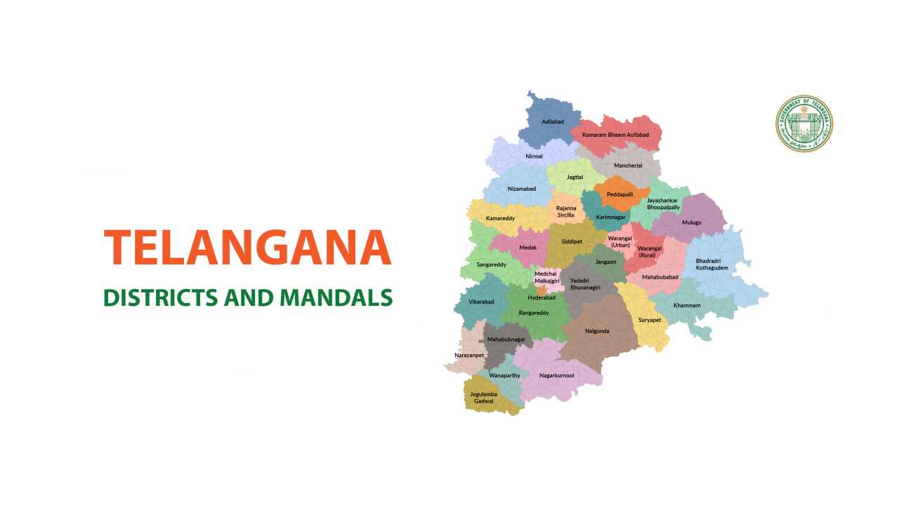
This dataset provides geospatial boundary shapefiles for Telangana's revenue administration, covering: Geographical Boundaries: 33 Districts 632 Mandals (sub-districts) Shapefile Details: GIS-compatible shapefiles for spatial analysis Can be used for mapping, geospatial analytics, and district-wise governance planning Data Availability: Dataset is available for download upon submission of the required form. The dataset is publicly available under the Open Government Data License, India.
 Dataset Metadata
Open Government License, India
Telangana, India
Other
Open Data Telangana
-
Structured
Annually
Annually
N.A.
19/02/25 11:50:58
Open
Hosted
 Activity Overview
 0
0 616
616  0
0  6,291
6,291
 Tags
Tags
- Geospatial Data
- GIS
- Administrative Boundaries
- Telangana
- governance
- Telangana maps
- mandals
- shapefiles
- revenue divisions
- districts
 License Control
Open Government License, India
© 2026 - Copyright AIKosh. All rights reserved.